Maliyami Formation Agglomerate
Submitted by Houda Bouammar on Fri, 11/05/2018 - 09:59 | Last updated: Fri, 11/05/2018 - 09:59
Grid Ref (WGS84 Lat/Long in decimal degrees)
-18.978427, 29.257150
Location:
66km West of Kwekwe on the main road to Nkai
Stratigraphy:
Maliyami Formation-Bulawayn Supergroup
Description:
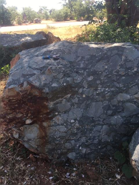
3.6km past the Gweru river bridge, coming from Kwekwe, look out for large boulders of agglomerate rocks on both sides of the tarred road.
Together with amygdaloidal and porphyritic andesitic lavas, phyllites and cherts, these agglomerates form the Maliyami Formation of the Bulawayan Supergroup which in the Gweru-Vungu Valleys area represents the larger portion of the greenstone belt.
Further Reading:
Zimbabwe Geological Survey - Short Report S.R. 48
Contributed:
11/05/2018
Updated:
11/05/2018